SalenGeneral information - Location
| Country | Scotland |
| Part of |
United Kingdom |
| Location in country |  Northwest |
| Location in Europe |
West Europe |
| Coordinates (WGS84) | Long: -5.9473,Lat: 56.5163  |
| Elevation | 58 meter above sea level | | Local time | 1:27:20am
|
| At island | Mull | | Name province/region (Country) | Scotland | | Wiki-website Council Area (Council Area) | Argyll and Bute | | Name Electoral Ward | Oban South and the Isles | | Other place with same name 1 |  Salen
Dalarnas län - Malung-Sälen | | Other place with same name 2 |  Salen
Scotland - Highland | | Other place with same name 3 |  Salen
Thurgau - Frauenfeld |
Nearest 5 places
Nearest 3 capitals
| Capitalname |
Country |
Distance |
Direction |
| 1 Glasgow | Scotland | 133 km |  SouthEast
| | 2 Belfast |  Northern-ireland | 214 km |  SouthSouthWest
| | 3 Douglas |  Isle-of-man | 279 km |  South
|
Characteristics - Physical GeographySalen lies at the Atlantic Ocean (direction WestNorthWest). The nearest bigger lake is Loch Bà (2.7 km2 at a distance of 4.1 km in SouthSouthWestern direction).
The most nearby international border is the
North-Irish-Irish border with a straight distance of 181.7 km in SouthWestern direction. The estimated travel distance is around 254 km.
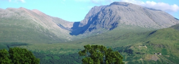
Elevation around place: very low location (near sea level): 6%, low location: 76%, hill: 18%, The hills are mainly northeastern orientated. The most common land use in the area is forest.
Name area (subregions, nature area, hills, mountains, landscape)
Nearby scheduled flights are operated from (national) airport Glasgow International Airport (at a distance of 118 km and direction SouthEast).The closest smaller (subnational) airport is Tiree Airport (at a distance of 57 km in Western direction).
Landscape - Landuse (within 5km)
| Forest |
20.9 km2 |
|
| Nature |
20.2 km2 |
|
| Wet nature |
5 km2 |
|
| Agriculture |
7.8 km2 |
|
| Rock-Sand |
0.4 km2 |
|
| Water - Lakes |
1.4 km2 |
|
|
|
Climate - Temperature and Precipitation
|
Location of Salen in country Scotland
Tourist information - Travel Guide
Nearest 3 UNESCO-sites
| Name |
Country |
Distance |
Direction |
| 1 Giant's Causeway and Causeway Coast | United Kingdom of Great Britain and Northern Ireland | 146 km |
SouthSouthWest
| | 2 New Lanark | United Kingdom of Great Britain and Northern Ireland | 164 km |
SouthEast
| | 3 The Forth Bridge | United Kingdom of Great Britain and Northern Ireland | 168 km |  EastSouthEast
|
Social media - Maps
|


 Hotels at Salen
 NorthNorthWest
 WestSouthWest
 SouthWest


 Filming Location


