KolturGeneral information - Location
| Country | Faroe Islands | | Location in country |  South |
| Location in Europe |
North Europe |
| Coordinates (WGS84) | Long: -6.9706,Lat: 61.9891  |
| Elevation | 1 meter above sea level | | Local time | 13:42:58pm
|
| At island | Koltur | | Name province/region (Sysler) | Streymoy | | Wiki-website Kommuna (Kommuna) | Tórshavn |
Nearest 5 places
Nearest 3 capitals
| Capitalname |
Country |
Distance |
Direction |
| 1 Tórshavn | Faroe-islands | 12 km |  East
| | 2 Glasgow |  Scotland | 707 km |
South
| | 3 Reykjavík |  Iceland | 782 km |  NorthWest
|
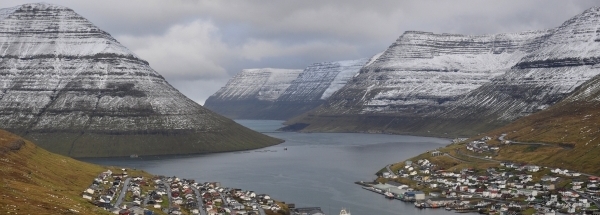
Characteristics - Physical GeographyKoltur lies at the Atlantic Ocean (direction EastNorthEast). The nearest bigger lake is Søvagsvatn (3.2 km2 at a distance of 14.1 km in NorthWestern direction).The place is located at an island named Koltur. The distance to the mainland is 387.7 km.
Elevation around place: very low location (near sea level): 20%, low location: 51%, hill: 29%, The hills are mainly flatern orientated.
Nearby scheduled flights are operated from (national) airport Bergen Airport, Flesland (at a distance of 681 km and direction EastSouthEast).The closest smaller (subnational) airport is Vágar Airport (at a distance of 18 km in NorthWestern direction).
Climate - Temperature and Precipitation
|
Location of Koltur in country Faroe-islands
Tourist information - Travel Guide
Nearest 3 UNESCO-sites
Social media - Maps
|

 Travel guide Koltur


 Hotels at Koltur
 EastNorthEast
 SouthEast
 EastSouthEast
 NorthEast


 SouthSouthEast
 SouthSouthWest


 Filming Location


