VårøGeneral information - Location
| Country | Denmark | | Location in country |  Southeast |
| Location in Europe |
North Europe |
| Coordinates (WGS84) | Long: 10.5856,Lat: 54.9605  |
| Elevation | 3 meter above sea level | | Local time | 21:48:42pm |
| At island | Tåsinge | | Name province/region (Region) | Syddanmark | | Wiki-website Kommune (Kommune) | Svendborg | | Name Sub(sub)region - municipality | Bjerreby |
Nearest 5 places
Nearest 3 capitals
| Capitalname |
Country |
Distance |
Direction |
| 1 København | Denmark | 152 km |  NorthEast
| | 2 Berlin |  Germany | 329 km |
SouthEast
| | 3 Amsterdam |  Netherlands | 474 km |  SouthWest
|
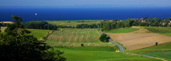
Characteristics - Physical GeographyVårø lies at the Baltic Sea (direction South).The place is situated in the rivercatchment named Jutland and Funen. The nearest bigger lake is Brandegård Sø (0.8 km2 at a distance of 22.2 km in NorthWestern direction).The place is located at an island named Tåsinge. The distance to the mainland is 42.4 km.
The most nearby international border is the
Danish-German border with a straight distance of 76.2 km in Western direction. The estimated travel distance is around 107 km.
Elevation around place: very low location (near sea level): 89%, low location: 11%, The surroundings of the place have a rural character (very sparsely urbanised). The most common land use in the area is agriculture.
Nearby scheduled flights are operated from (national) airport Billund Airport (at a distance of 126 km and direction NorthWest).The closest smaller (subnational) airport is Sønderborg Airport (at a distance of 51 km in Western direction).
Landscape - Landuse (within 5km)
| Forest |
0.9 km2 |
|
| Wet nature |
1.3 km2 |
|
| Agriculture |
33.8 km2 |
|
| Urban area |
0.7 km2 |
|
| Water - Lakes |
0.4 km2 |
|
|
|
Climate - Temperature and Precipitation
|
Location of Vårø in country Denmark
Tourist information - Travel Guide
Nearest 3 UNESCO-sites
Nearest Natura2000-area
Social media - Maps
|

 Travel guide Vårø


 Hotels at Vårø
 East
 NorthWest
 NorthNorthWest
 WestNorthWest


 Filming Location


