BrenderupGeneral information - Location
| Country | Denmark | | Location in country |  Southeast |
| Location in Europe |
North Europe |
| Coordinates (WGS84) | Long: 9.9706,Lat: 55.4807  |
| Elevation | 15 meter above sea level | | Local time | 23:03:04pm |
| At island | Fyn | | Name province/region (Region) | Syddanmark | | Wiki-website Kommune (Kommune) | Middelfart | | Name Sub(sub)region - municipality | Brenderup |
Nearest 5 places
Nearest 3 capitals
| Capitalname |
Country |
Distance |
Direction |
| 1 København | Denmark | 167 km |  East
| | 2 Berlin |  Germany | 398 km |
SouthEast
| | 3 Amsterdam |  Netherlands | 480 km |  SouthWest
|
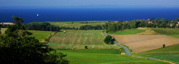
Characteristics - Physical GeographyThe Baltic Sea is very close with only a distance of around 4 km (direction NorthNorthWest).The place is situated in the rivercatchment named Jutland and Funen. The nearest bigger lake is Rands Fjord (1.5 km2 at a distance of 21 km in NorthWestern direction).The place is located at an island named Fyn. The distance to the mainland is 0.6 km.
The nearest mountain is Frøbjerg Bavnehøj with a height of 131 meter (at a distance of 18.3 km and direction SouthSouthEast).
The most nearby international border is the
Danish-German border with a straight distance of 79.5 km in SouthSouthWestern direction. The estimated travel distance is around 111 km.
Elevation around place: very low location (near sea level): 12%, low location: 88%, The hills are mainly northern orientated.The surroundings of the place have a rural character (very sparsely urbanised). The most common land use in the area is agriculture.
Nearby scheduled flights are operated from (national) airport Billund Airport (at a distance of 59 km and direction WestNorthWest).The closest smaller (subnational) airport is Odense Airport (at a distance of 23 km in Eastern direction).
Landscape - Landuse (within 5km)
| Forest |
3 km2 |
|
| Wet nature |
0.8 km2 |
|
| Agriculture |
67.3 km2 |
|
| Urban area |
3.5 km2 |
|
|
|
Climate - Temperature and Precipitation
|
Location of Brenderup in country Denmark
Tourist information - Travel Guide
Nearest 3 UNESCO-sites
Nearest Natura2000-area
Social media - Maps
|

 Travel guide Brenderup


 Hotels at Brenderup
 SouthSouthWest
 West
 WestNorthWest
 NorthNorthEast


 WestSouthWest
 NorthWest
 NorthNorthWest


 Filming Location


