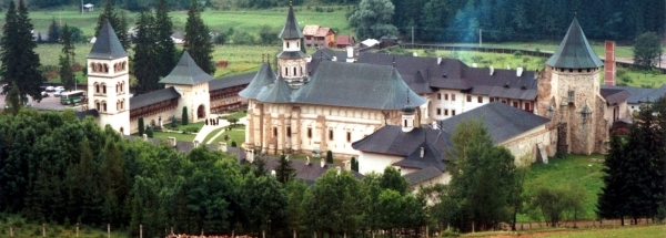
 Cistei
 |
|||||||||||||||||||||||||||||||||||||||||||||||||||||||||||||||||||||||||||||||||||||||||||||||||||||||||||||||||||||||||
|
|
Booking.com | ||||||||||||||||||||||||||||||||||||||||||||||||||||||||||||||||||||||||||||||||||||||||||||||||||||||||||||||||||||||||
CisteiGeneral information - LocationNearest 5 places
Nearest 3 capitals
Characteristics - Physical GeographyThe Black Sea is the nearest seacoast with a distance of around 433 km (direction EastSouthEast).The place is situated in the rivercatchment named Mures, part of the larger catchment area Danube Region Basin District. The nearest bigger lake (reservoir) is Râura (1.5 km2 at a distance of 37.8 km in SouthEastern direction).The most nearby international border is the Romanian-Hungarian border with a straight distance of 180.6 km in WestNorthWestern direction. The estimated travel distance is around 253 km. Elevation around place: hill: 100%, The hills are mainly western orientated. The most common land use in the area is agriculture. Name area (subregions, nature area, hills, mountains, landscape)
Nearby scheduled flights are operated from (national) airport Henri Coanda International Airport (at a distance of 254 km and direction EastSouthEast). Landscape - Landuse (within 5km)
Climate - Temperature and Precipitation |
Location of Cistei in country Romania
Cistei at Physical map (height map)Tourist information - Travel GuideNearest 3 UNESCO-sites
Nearest Natura2000-area
Social media - Maps
|
||||||||||||||||||||||||||||||||||||||||||||||||||||||||||||||||||||||||||||||||||||||||||||||||||||||||||||||||||||||||
Relief: Altitude classes in percent (within 5km)Relief: slope classes in percent (within 5km) |
Current weather at Mihalţ
Weather coming 24 hoursMihalţ - RO (longitude: 23.756, latitude: 46.1819)Distance weather station to place (direction NO): 0 Kilometers
|
||||||||||||||||||||||||||||||||||||||||||||||||||||||||||||||||||||||||||||||||||||||||||||||||||||||||||||||||||||||||
5 days Weather forecast: Temperature - Pressure and PrecipitationPressure (mbar)
Wind speed (km/h)
hours
Cloud cover %
precipitation (mm)
hours
|
|||||||||||||||||||||||||||||||||||||||||||||||||||||||||||||||||||||||||||||||||||||||||||||||||||||||||||||||||||||||||
|
Widget is loading comments...
|
|||||||||||||||||||||||||||||||||||||||||||||||||||||||||||||||||||||||||||||||||||||||||||||||||||||||||||||||||||||||||
| number of views: 23 | |||||||||||||||||||||||||||||||||||||||||||||||||||||||||||||||||||||||||||||||||||||||||||||||||||||||||||||||||||||||||


 ©
© 


 Filming Location


