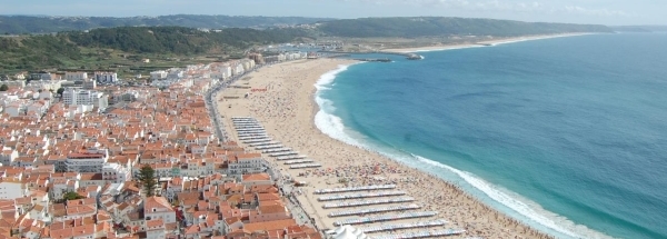
 Criação Velha
 |
|||||||||||||||||||||||||||||||||||||||||||||||||||||||||||||||||||||||||||||||||||||||||||||||||||||||
|
|
Booking.com | ||||||||||||||||||||||||||||||||||||||||||||||||||||||||||||||||||||||||||||||||||||||||||||||||||||||
Criação VelhaGeneral information - Location
Nearest 5 places
Nearest 3 capitals
Characteristics - Physical GeographyCriação Velha lies at the Atlantic Ocean (direction North). The nearest bigger lake is Lagoa das Furnas (1.8 km2 at a height of around 279 meter above sea level) at a distance of 8.4 km in SouthSouthWestern direction).The nearest vulcano (within 50 km) is the Furnas (Stratovolcano) at a distance of 8.5 km (direction South). The most nearby international border is the Portugese-Spanish border with a straight distance of 1457.5 km in Eastern direction. The estimated travel distance is around 2041 km. Elevation around place: very low location (near sea level): 0%, low location: 22%, hill: 75%, low mountains: 3%, The hills are mainly northern orientated. The most common land use in the area is . Nearby scheduled flights are operated from (national) airport João Paulo II Airport (at a distance of 32 km and direction West).The closest smaller (subnational) airport is Santa Maria Airport (at a distance of 99 km in SouthSouthWestern direction). Landscape - Landuse (within 5km)Climate - Temperature and Precipitation |
Location of Criação Velha in country Portugal
Criação Velha at Physical map (height map)Tourist information - Travel GuideNearest 3 UNESCO-sites
Nearest Natura2000-area
Social media - Maps
|
||||||||||||||||||||||||||||||||||||||||||||||||||||||||||||||||||||||||||||||||||||||||||||||||||||||
Relief: Altitude classes in percent (within 5km)Relief: slope classes in percent (within 5km) |
Current weather at Furnas
Weather coming 24 hoursFurnas - PT (longitude: -25.3468, latitude: 37.8415)Distance weather station to place (direction NNW): 0.01 Kilometers
|
||||||||||||||||||||||||||||||||||||||||||||||||||||||||||||||||||||||||||||||||||||||||||||||||||||||
5 days Weather forecast: Temperature - Pressure and PrecipitationPressure (mbar)
Wind speed (km/h)
hours
Cloud cover %
precipitation (mm)
hours
|
|||||||||||||||||||||||||||||||||||||||||||||||||||||||||||||||||||||||||||||||||||||||||||||||||||||||
|
Widget is loading comments...
|
|||||||||||||||||||||||||||||||||||||||||||||||||||||||||||||||||||||||||||||||||||||||||||||||||||||||
| number of views: 45 | |||||||||||||||||||||||||||||||||||||||||||||||||||||||||||||||||||||||||||||||||||||||||||||||||||||||


 ©
© 


 Filming Location


