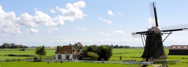
 Nieuw-Vennep
 |
|||||||||||||||||||||||||||||||||||||||||||||||||||||||||||||||||||||||||||||||||||||||||||||||||||||||||||||||||||
|
|
Booking.com | ||||||||||||||||||||||||||||||||||||||||||||||||||||||||||||||||||||||||||||||||||||||||||||||||||||||||||||||||||
Nieuw-VennepGeneral information - LocationNearest 5 places
Nearest 3 capitals
Characteristics - Physical GeographyThe North Sea is the nearest seacoast with a distance of around 12 km (direction WestNorthWest).The place is situated in the rivercatchment named Rhine coastal: Lek, part of the larger catchment area Rhine. The nearest bigger lake is Toolenburg (0.6 km2 at a distance of 3.3 km in NorthNorthEastern direction).The most nearby international border is the Dutch-Belgium border with a straight distance of 85.2 km in Southern direction. The estimated travel distance is around 119 km. Elevation around place: very low location (near sea level): 100%, The surroundings of the place is moderately urbanised. The most common land use in the area is agriculture. Name area (subregions, nature area, hills, mountains, landscape)
Nearby scheduled flights are operated from (national) airport Amsterdam Airport Schiphol (at a distance of 10 km and direction EastNorthEast).The closest smaller (subnational) airport is Rotterdam The Hague Airport (at a distance of 37 km in SouthSouthWestern direction). Landscape - Landuse (within 5km)
Climate - Temperature and Precipitation |
Location of Nieuw-Vennep in country Netherlands
Nieuw-Vennep at Physical map (height map)Tourist information - Travel GuideNearest 3 UNESCO-sites
Nearest Natura2000-area
Social media - Maps
|
||||||||||||||||||||||||||||||||||||||||||||||||||||||||||||||||||||||||||||||||||||||||||||||||||||||||||||||||||
Relief: Altitude classes in percent (within 5km)Relief: slope classes in percent (within 5km) |
Current weather at Gemeente Hillegom
Weather coming 24 hoursGemeente Hillegom - NL (longitude: 4.6344, latitude: 52.2656)Distance weather station to place (direction N): not known
|
||||||||||||||||||||||||||||||||||||||||||||||||||||||||||||||||||||||||||||||||||||||||||||||||||||||||||||||||||
5 days Weather forecast: Temperature - Pressure and PrecipitationPressure (mbar)
Wind speed (km/h)
hours
Cloud cover %
precipitation (mm)
hours
|
|||||||||||||||||||||||||||||||||||||||||||||||||||||||||||||||||||||||||||||||||||||||||||||||||||||||||||||||||||
|
Widget is loading comments...
|
|||||||||||||||||||||||||||||||||||||||||||||||||||||||||||||||||||||||||||||||||||||||||||||||||||||||||||||||||||
| number of views: 29 | |||||||||||||||||||||||||||||||||||||||||||||||||||||||||||||||||||||||||||||||||||||||||||||||||||||||||||||||||||


 ©
© 


 Filming Location


